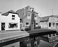
Category:'s-Herenstraat 53, Maasland
Jump to navigation
Jump to search

| Object location | | View all coordinates using: OpenStreetMap - Google Earth - Proximityrama |
|---|
 | |||||
| Instance of | building | ||||
| Location | Midden-Delfland, South Holland, Netherlands | ||||
| Located at street address |
| ||||
| Heritage designation |
| ||||
| |||||
|
|
|||||
|
This is a category about rijksmonument number 26576 |
Address
| 's-Herenstraat 53 Maasland Netherlands |
Media in category "'s-Herenstraat 53, Maasland"
The following 8 files are in this category, out of 8 total.
 Gevel - Maasland - 20144643 - RCE.jpg 1,200 × 961; 253 KB
 Gevel - Maasland - 20144644 - RCE.jpg 1,200 × 966; 216 KB
 Maasland - 's Herenstraat 53.jpg 2,592 × 1,944; 1.54 MB
 Overzicht - Maasland - 20144637 - RCE.jpg 1,200 × 947; 231 KB
 Overzicht - Maasland - 20144646 - RCE.jpg 1,200 × 963; 232 KB
 Overzicht - Maasland - 20144647 - RCE.jpg 1,200 × 961; 217 KB
 Overzicht - Maasland - 20144653 - RCE.jpg 1,200 × 946; 301 KB
 Voorgevel - Maasland - 20144645 - RCE.jpg 1,200 × 966; 241 KB


