Category:Geography of the United States
Jump to navigation
Jump to search

geography of the United States of America | |||||
| Instance of | geography of geographic location | ||||
| Subclass of | geography of North America | ||||
| Facet of | United States of America | ||||
| Category combines topics | geography, United States of America | ||||
| Location | |||||
| |||||
Subcategories
This category has the following 37 subcategories, out of 37 total.
+
A
B
C
G
H
L
M
N
P
S
T
U
W
Media in category "Geography of the United States"
The following 200 files are in this category, out of 249 total.
(previous page) (next page) 10 Largest By population 2010.png 1,100 × 700; 106 KB
 135 of 'La Vie Américaine. Ouvrage illustré, etc' (11218787794).jpg 2,992 × 1,904; 1.09 MB
- Aurora Borealis and eastern United States at Night.ogv 36 s, 840 × 560; 9.28 MB
- Aurora Borealis and the United States at Night.ogv 33 s, 840 × 560; 12.33 MB
- Aurora Borealis Pass over the United States at Night.ogv 21 s, 840 × 560; 4.07 MB
 Belle Fourche.jpg 746 × 774; 719 KB
 Border Patrol 1919-1921.jpg 1,590 × 903; 191 KB
 Boston MA DaylightChart.png 969 × 685; 46 KB
 Boswash.png 2,000 × 2,667; 1.8 MB
 Cafta countries.png 458 × 344; 9 KB
 Central Nevada Desert Basins.JPG 622 × 908; 82 KB
 Conus elevation lin 01.svg 991 × 392; 191 KB
 Conus elevation log.svg 991 × 392; 151 KB
 Cotton belt.svg 959 × 593; 90 KB
 Dakotas.svg 959 × 593; 90 KB
 Daly2medal.jpg 300 × 195; 23 KB
 Department of the Platte.PNG 386 × 180; 5 KB
 Early June 2008 rainfall.png 620 × 366; 105 KB
 Edson 4865579679 fc9cb53efb o.jpg 584 × 728; 208 KB
 Elementary physical geography (1907) (14585296730).jpg 2,384 × 1,516; 609 KB
 Fig8south.jpg 2,048 × 1,536; 559 KB
 Frank Thorn NOAA crop.jpg 605 × 859; 162 KB
 Frank Thorn NOAA.jpg 700 × 1,072; 222 KB
 Global Entry Kiosk.jpg 360 × 166; 20 KB
 Global Entry Logo Negative.svg 400 × 150; 62 KB
 Greenubique.gif 84 × 72; 2 KB
 HUC 031300010106 - Blue Creek-Chattahoochee River.PNG 464 × 491; 512 KB
 HUC 031300010106 topographical map.tiff 1,290 × 1,194; 3.15 MB
 HUC 031300010201 - Headwaters Soque River.PNG 505 × 447; 529 KB
 HUC 031300010202 topographical map.PNG 374 × 624; 407 KB
 HUC 031300010203 - Deep Creek.PNG 316 × 555; 403 KB
 HUC 031300010203 topographical map.PNG 453 × 616; 502 KB
 HUC 031300010206 topographical map.PNG 535 × 660; 691 KB
 HUC 031300010301 - White Creek-Chattahoochee River.tiff 872 × 928; 1.78 MB
 HUC 031300010301 topographic map.tiff 686 × 940; 1.32 MB
 HUC 031300010302 - Mossy Creek.tiff 890 × 962; 1.83 MB
 HUC 031300010302 topographic map.tiff 1,012 × 1,020; 2.13 MB
 HUC 031300010303 - Mud Creek.tiff 1,128 × 982; 2.47 MB
 HUC 031300010303 topographic map.tiff 1,318 × 1,088; 3.8 MB
 HUC 031300010304 - Flat Creek-Chattahoochee River.tiff 1,156 × 1,102; 2.79 MB
 HUC 031300010304 topographic map.tiff 1,622 × 1,252; 5.54 MB
 HUC 031300010305 - Limestone Creek-Chattahoochee River.tiff 1,176 × 1,032; 2.62 MB
 HUC 031300010305 topographic map.tiff 1,556 × 1,274; 5.9 MB
 HUC 031300010401 - Wahoo Creek.tiff 1,210 × 1,570; 4.06 MB
 HUC 031300010401 topographic map.tiff 1,370 × 1,438; 5.13 MB
 HUC 0313000105 to 07 - Chestatee River watersheds.tiff 670 × 1,000; 1.62 MB
 HUC 0313000105 to 07 topographic map - Chestatee River area.tiff 568 × 940; 675 KB
 HUC 031300010501 - Dicks Creek.tiff 1,042 × 752; 1.65 MB
 HUC 031300010501 topographic map.tiff 1,296 × 916; 3.12 MB
 HUC 031300010502 and 504 - Tesnatee Creek.tiff 1,040 × 1,296; 2.96 MB
 HUC 031300010502 and 504 topographic map.tiff 1,210 × 1,606; 4.29 MB
 HUC 031300010503 - Town Creek.tiff 620 × 1,180; 1.6 MB
 HUC 031300010503 topographic map.tiff 670 × 1,616; 2.55 MB
 HUC 031300010505 - Tate Creek-Chestatee River.tiff 806 × 932; 1.72 MB
 HUC 031300010505 topographic map.tiff 1,224 × 1,332; 3.82 MB
 HUC 031300010601 - Cavenders Creek-Chestatee River.tiff 854 × 822; 1.67 MB
 HUC 031300010601 topographic map.tiff 1,696 × 1,102; 4.27 MB
 HUC 031300010602 - Yahoola Creek.tiff 750 × 1,272; 2.25 MB
 HUC 031300010602 topographic map.tiff 790 × 1,434; 3.1 MB
 HUC 031300010603 - Cane Creek.tiff 654 × 1,222; 1.93 MB
 HUC 031300010604 - Long Branch-Chestatee River.tiff 918 × 594; 1.31 MB
 HUC 031300010604 topographic.tiff 800 × 1,170; 2.59 MB
 HUC 031300010701 - Yellow Creek-Chestatee River.tiff 950 × 706; 1.5 MB
 HUC 031300010701 topographic map.tiff 1,012 × 1,068; 3.25 MB
 HUC 031300010702 topographic map.tiff 1,064 × 1,064; 3.47 MB
 HUC 031300010703 topographic map.tiff 1,002 × 912; 2.68 MB
 HUC 031300010704 - Taylor Creek-Chestatee River.tiff 786 × 490; 814 KB
 HUC 031300010704 topographic map.tiff 1,140 × 738; 2.55 MB
 HUC 031300010705 - Martin Creek-Lake Sidney Lanier.PNG 909 × 595; 931 KB
 HUC 031300010705 topographic map.tiff 1,116 × 766; 2.66 MB
 HUC 0313000108 - Lake Lanier watersheds.tiff 1,040 × 938; 2.23 MB
 HUC 0313000108 topographic map - Lake Lanier area.tiff 1,818 × 1,386; 7.74 MB
 HUC 031300010801 - Upper Lake Sidney Lanier.tiff 1,152 × 1,118; 2.54 MB
 HUC 031300010802 - Flat Creek.tiff 1,016 × 728; 1.4 MB
 HUC 031300010802 topographic map.tiff 1,560 × 1,132; 5.43 MB
 Huc region-edit.png 500 × 320; 17 KB
 HUC01.jpg 632 × 434; 204 KB
 HUC0101.jpg 632 × 434; 308 KB
 HUC0102.jpg 632 × 434; 485 KB
 HUC0103.jpg 632 × 434; 464 KB
 HUC0104.jpg 636 × 438; 325 KB
 HUC0105.jpg 632 × 434; 508 KB
 HUC0106.jpg 632 × 434; 370 KB
 HUC0107.jpg 632 × 434; 421 KB
 HUC0108.jpg 632 × 434; 511 KB
 HUC0109.jpg 632 × 434; 434 KB
 HUC0110.jpg 636 × 438; 323 KB
 HUC0111.jpg 632 × 434; 204 KB
 HUC02.jpg 636 × 438; 236 KB
 HUC0201.jpg 632 × 434; 422 KB
 HUC0202.jpg 632 × 434; 494 KB
 HUC0203.jpg 632 × 434; 435 KB
 HUC0204.jpg 636 × 438; 464 KB
 HUC0205.jpg 632 × 434; 509 KB
 HUC0206.jpg 636 × 438; 387 KB
 HUC0207.jpg 636 × 438; 537 KB
 HUC0208.jpg 632 × 434; 507 KB
 HUC03.jpg 632 × 434; 265 KB
 HUC0301.jpg 632 × 434; 504 KB
 HUC0302.jpg 632 × 434; 443 KB
 HUC0303.jpg 632 × 434; 437 KB
 HUC0304.jpg 632 × 434; 523 KB
 HUC0305.jpg 632 × 434; 548 KB
 HUC0306.jpg 632 × 434; 533 KB
 HUC0307.jpg 632 × 434; 530 KB
 HUC0308.jpg 632 × 434; 457 KB
 HUC0309.jpg 632 × 434; 471 KB
 HUC0310.jpg 636 × 438; 168 KB
 HUC0311.jpg 632 × 434; 446 KB
 HUC0312.jpg 632 × 434; 312 KB
 HUC0313.jpg 632 × 434; 560 KB
 HUC031300.jpg 636 × 438; 484 KB
 HUC03130001.jpg 636 × 438; 381 KB
 HUC03130002.jpg 636 × 438; 409 KB
 HUC03130003.jpg 636 × 438; 318 KB
 HUC03130004.jpg 636 × 438; 293 KB
 HUC03130005.jpg 636 × 438; 370 KB
 HUC03130006.jpg 636 × 438; 295 KB
 HUC03130007.jpg 636 × 438; 230 KB
 HUC03130008.jpg 636 × 438; 302 KB
 HUC03130009.jpg 636 × 438; 250 KB
 HUC03130010.jpg 636 × 438; 233 KB
 HUC03130011.jpg 636 × 438; 250 KB
 HUC03130012.jpg 636 × 438; 305 KB
 HUC03130013.jpg 636 × 438; 163 KB
 HUC03130014.jpg 636 × 438; 120 KB
 HUC0314.jpg 632 × 434; 458 KB
 HUC0315.jpg 632 × 434; 557 KB
 HUC0316.jpg 632 × 434; 545 KB
 HUC0317.jpg 632 × 434; 451 KB
 HUC0318.jpg 632 × 434; 483 KB
 HUC04.jpg 632 × 434; 242 KB
 HUC0401.jpg 632 × 434; 411 KB
 HUC0402.jpg 632 × 434; 484 KB
 HUC0403.jpg 632 × 434; 506 KB
 HUC0404.jpg 632 × 434; 394 KB
 HUC0405.jpg 636 × 438; 338 KB
 HUC05.jpg 631 × 434; 230 KB
 HUC06.jpg 632 × 434; 126 KB
 HUC07.jpg 640 × 434; 237 KB
 HUC0701.jpg 632 × 434; 432 KB
 HUC0702.jpg 632 × 434; 446 KB
 HUC0703.jpg 632 × 434; 371 KB
 HUC0704.jpg 632 × 434; 366 KB
 HUC0705.jpg 632 × 434; 374 KB
 HUC0706.jpg 632 × 434; 378 KB
 HUC0707.jpg 636 × 434; 492 KB
 HUC0708.jpg 632 × 434; 511 KB
 HUC0709.jpg 632 × 434; 436 KB
 HUC0710.jpg 632 × 434; 529 KB
 HUC0711.jpg 632 × 434; 488 KB
 HUC0712.jpg 636 × 438; 397 KB
 HUC0713.jpg 636 × 438; 467 KB
 HUC0714.jpg 636 × 438; 520 KB
 HUC08.jpg 632 × 434; 178 KB
 HUC0801.jpg 632 × 434; 448 KB
 HUC0802.jpg 632 × 434; 538 KB
 HUC0803.jpg 632 × 434; 434 KB
 HUC09.jpg 632 × 434; 112 KB
 HUC10.jpg 632 × 434; 272 KB
 HUC11.jpg 632 × 434; 189 KB
 HUC12.jpg 632 × 434; 189 KB
 HUC13.jpg 632 × 434; 214 KB
 HUC14.jpg 632 × 434; 135 KB
 HUC15.jpg 632 × 434; 166 KB
 HUC16.jpg 636 × 438; 184 KB
 HUC17.jpg 632 × 434; 209 KB
 HUC18.jpg 632 × 434; 196 KB
 HUC19.jpg 636 × 445; 230 KB
 HUC20.jpg 636 × 438; 112 KB
 HUC21.jpg 635 × 437; 113 KB
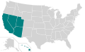
 Inland Northwest United States.svg 280 × 280; 383 KB
 June 5, 2008 1300 outlook.jpg 581 × 408; 77 KB
 KentuckPortoRico.jpg 270 × 281; 30 KB
 Largest cities in the United States by population by decade Visualization.png 1,100 × 700; 106 KB
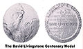 Livingstonemedal.jpg 300 × 180; 19 KB
 LLWS Central.svg 959 × 593; 107 KB
 LLWS East.svg 959 × 593; 100 KB
 LLWS Great Lakes.svg 959 × 593; 97 KB
 LLWS Mid-Atlantic.svg 959 × 593; 94 KB
 LLWS Midwest.svg 959 × 593; 95 KB
 LLWS New England.svg 959 × 593; 94 KB
 LLWS Northwest.svg 959 × 593; 105 KB
 LLWS South.svg 959 × 593; 113 KB
 LLWS Southeast.svg 959 × 593; 100 KB
 LLWS Southwest.svg 959 × 593; 98 KB
 LLWS West 1957-2000.svg 959 × 593; 117 KB
 LLWS West.svg 959 × 593; 98 KB
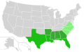
 Map of USA highlighting coastal states.png 904 × 593; 25 KB
 Map of USA highlighting coastal states.svg 959 × 593; 89 KB
 Map of USA highlighting Grain Belt.png 280 × 183; 40 KB
 Marine boundary US - Cuba.jpg 1,038 × 1,192; 127 KB
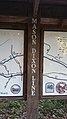 Mason Dixon Line - Rail Trail.jpg 2,988 × 5,312; 5.27 MB
 Megalopolis.png 1,200 × 2,100; 591 KB
 Millermedal.jpg 305 × 192; 22 KB
 NCMap-doton-HotSprings.PNG 300 × 117; 9 KB
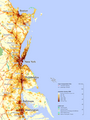
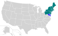
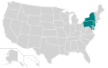
 Northeast&FloridaMegalopolis.jpg 1,200 × 891; 779 KB
- Pass over Canada and Central United States at Night.ogv 32 s, 840 × 560; 7.06 MB
 Physiographic legend.jpg 345 × 504; 32 KB

.jpg)


_(14585296730).jpg)


