Category:Maps
Jump to navigation
Jump to search
 The article Maps on Wikipedia projects: (en) Map ·
(an) Mapa · (ar) خريطة · (ast) Mapa · (bg) Карта · (bn) মানচিত্র · (bs) Karta · (ca) Plànol · (cs) Mapa · (cy) Map · (da) Kort (geografi) · (de) Karte (Kartografie) · (eo) Mapo · (es) Mapa · (et) Kaart (kartograafia) · (fa) نقشه (زمین) · (fi) Kartta · (fr) Carte géographique · (gan) 地圖 · (gl) Mapa · (he) מפה · (hi) मानचित्र · (hr) Karta · (hu) Térkép · (id) Peta · (is) Kort · (it) Mappa · (ja) 地図 · (ka) გეოგრაფიული რუკა · (ko) 지도 · (la) Tabula geographica · (lb) Landkaart · (lt) Žemėlapis · (ml) ഭൂപടം · (ms) Peta · (nl) Kaart (cartografie) · (nn) Kart · (no) Kart · (oc) Mapa · (pl) Mapa · (pt) Mapa · (ro) Hartă · (ru) Географическая карта · (sa) Хаарта · (sco) Cairt · (si) ple:Map · (sk) Mapa · (sl) Zemljevid · (sq) Harta · (sr) Карта (мапа) · (su) Atlas · (sv) Karta · (sw) Ramani · (ta) நிலப்படம் · (tg) Харита · (th) แผนที่ · (tl) Mapa · (tr) Harita · (uk) Географічна карта · (vi) Bản đồ · (yi) מאפע · (zh) 地图 · (zh-classical) 地圖 · (zh-yue) 地圖 ·

(an) Mapa · (ar) خريطة · (ast) Mapa · (bg) Карта · (bn) মানচিত্র · (bs) Karta · (ca) Plànol · (cs) Mapa · (cy) Map · (da) Kort (geografi) · (de) Karte (Kartografie) · (eo) Mapo · (es) Mapa · (et) Kaart (kartograafia) · (fa) نقشه (زمین) · (fi) Kartta · (fr) Carte géographique · (gan) 地圖 · (gl) Mapa · (he) מפה · (hi) मानचित्र · (hr) Karta · (hu) Térkép · (id) Peta · (is) Kort · (it) Mappa · (ja) 地図 · (ka) გეოგრაფიული რუკა · (ko) 지도 · (la) Tabula geographica · (lb) Landkaart · (lt) Žemėlapis · (ml) ഭൂപടം · (ms) Peta · (nl) Kaart (cartografie) · (nn) Kart · (no) Kart · (oc) Mapa · (pl) Mapa · (pt) Mapa · (ro) Hartă · (ru) Географическая карта · (sa) Хаарта · (sco) Cairt · (si) ple:Map · (sk) Mapa · (sl) Zemljevid · (sq) Harta · (sr) Карта (мапа) · (su) Atlas · (sv) Karta · (sw) Ramani · (ta) நிலப்படம் · (tg) Харита · (th) แผนที่ · (tl) Mapa · (tr) Harita · (uk) Географічна карта · (vi) Bản đồ · (yi) מאפע · (zh) 地图 · (zh-classical) 地圖 · (zh-yue) 地圖 ·
Before changing or adding maps, please read the brief guideline on the organizational schema About this Category developed during an eight month effort by a working group in 2007-2008.
- See also maps needing categories in Category:Unidentified maps
- See also these related categories: (These categories may contain more maps. Please categorize them in map categories.)
- Category:Cartography - for map symbols, projections, etc.
- Category:Demography
- Category:Geography
- Category:Aerial photographs
- Category:Satellite pictures
- Category:Astronomical maps - maps and star charts
- Category:Cartographic reliefs for models of landscape profiles
Resources:
 visual representation of an area | |||||
| Subclass of | communication medium, depiction, written work | ||||
| Part of | |||||
| |||||
Subcategories
This category has the following 30 subcategories, out of 30 total.
!
*
?
A
B
C
D
E
F
I
M
N
O
P
S
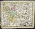
Media in category "Maps"
The following 200 files are in this category, out of 960 total.
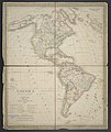
(previous page) (next page) 123 Santrampur Map.jpg 1,585 × 1,123; 224 KB
 1871 год.jpg 3,481 × 2,857; 1.66 MB
 1903 Routes between Tibet and India by O'Connor.jpg 6,340 × 4,888; 1.56 MB
 2000px Kingdom of León (1095).png 2,000 × 2,000; 666 KB
 2018 07 30 Fürstenberg KZ-Ravensbrück final.PNG 881 × 527; 431 KB
 2018 Ecce Homo mapka.jpg 1,524 × 850; 183 KB
 22303-G-A-Moray-The-State-of-Matrimony-1909.jpg 800 × 1,357; 313 KB
 A Bergschola utódintézményei Magyarországon.jpg 392 × 342; 20 KB
 A Chart of the Bank of Lagullus.jpg 9,329 × 5,165; 10.19 MB
 A Chart of the Cape Verd Islands.jpg 9,938 × 8,227; 16.21 MB
 A Chart of the Islands to the Southward of Tchu-San on the Eastern Coast of China.jpg 5,051 × 6,791; 7.17 MB
 A New and Accurate Map of Europe,1744.jpg 1,905 × 1,600; 3.49 MB
 A Plan of the City & Harbour of Louisburg.jpg 3,371 × 2,775; 2.84 MB
 A Survey of St. Jago.jpg 3,001 × 3,702; 4.06 MB
 A Survey of St. Lucea, Branco & Raza.jpg 3,824 × 2,969; 2.85 MB
 A Survey of St. Nicholas.jpg 4,233 × 2,949; 3.61 MB
 A wandering student in the Far East vol.1 -.jpg 3,809 × 3,337; 1.79 MB
 Abauntzako mapa 20180804 131534.jpg 4,128 × 3,096; 218 KB
 Abauntzako mapa 20180804 131537 retallat.jpg 1,304 × 796; 85 KB
 Abauntzako mapa 20180804 131537.jpg 4,128 × 3,096; 187 KB
 Adare-Seamounts-v1.png 811 × 441; 26 KB
 Aegyptus Antiqua - Mandato Serenissimi Delphini Publici Juris Facta.jpg 4,781 × 6,745; 8.25 MB
 Aegyptus Et Arabia Petraea (2).jpg 3,927 × 5,136; 5.19 MB
 Aegyptus Et Arabia Petraea.jpg 4,849 × 6,863; 7.52 MB
 Allgemeine Post- und Strassen-Karte des Russischen Reichs in Europa 01.jpg 5,373 × 4,929; 6.76 MB
 Allgemeine Post- und Strassen-Karte des Russischen Reichs in Europa 02.jpg 5,323 × 4,918; 6 MB
 Allgemeine Post- und Strassen-Karte des Russischen Reichs in Europa 03.jpg 5,336 × 4,897; 6.21 MB
 Allgemeine Post- und Strassen-Karte des Russischen Reichs in Europa 04.jpg 5,576 × 4,668; 9.58 MB
 Allgemeine Post- und Strassen-Karte des Russischen Reichs in Europa 05.jpg 5,315 × 4,688; 7.92 MB
 Allgemeine Post- und Strassen-Karte des Russischen Reichs in Europa 06.jpg 5,327 × 4,665; 7.12 MB
 Allgemeine Post- und Strassen-Karte des Russischen Reichs in Europa 07.jpg 5,538 × 4,752; 10.18 MB
 Allgemeine Post- und Strassen-Karte des Russischen Reichs in Europa 08.jpg 5,348 × 4,751; 9.65 MB
 Allgemeine Post- und Strassen-Karte des Russischen Reichs in Europa 09.jpg 5,265 × 4,733; 7.19 MB
 Allgemeine Post- und Strassen-Karte des Russischen Reichs in Europa 10.jpg 5,534 × 4,633; 8.47 MB
 Allgemeine Post- und Strassen-Karte des Russischen Reichs in Europa 11.jpg 5,350 × 4,679; 7.83 MB
 Allgemeine Post- und Strassen-Karte des Russischen Reichs in Europa 12.jpg 5,287 × 4,662; 5.83 MB
 AMD RoadsPlan.jpeg 1,195 × 1,358; 628 KB
 America - politische Karte.jpg 6,447 × 7,670; 15.04 MB
 America cum Supplementis Poly-Glottis.jpg 2,947 × 2,441; 1.92 MB
 America Meridonalis.jpg 4,168 × 2,631; 3.29 MB
 An Orometric Survey of Bonavista.jpg 3,780 × 2,977; 3.42 MB
 An Orometric Survey of Mayo.jpg 3,003 × 3,743; 2.55 MB
 An Orometric Survey of Sal.jpg 2,832 × 3,745; 2.64 MB
 An Éidheoin.png 788 × 1,100; 656 KB
 Analisi sfc color.png 1,332 × 1,600; 105 KB
 Ancient Nara.jpg 2,098 × 1,698; 621 KB
 ANTIS.jpg 2,912 × 3,044; 2.51 MB
 Apple Maps icon- MacOS.png 1,024 × 1,024; 528 KB
 Arab club champion cup teams.jpg.png 324 × 265; 11 KB
 Arab League updated.png 800 × 800; 120 KB
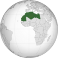 Arab Maghreb Union 2.png 553 × 553; 121 KB
 Areas of Parranda.png 169 × 156; 16 KB
 Arran's Greenock-St George's Bay route 1868.png 1,451 × 839; 250 KB
 Asia Minor, Syria, Mesopotamia, Armenia, Assyria 01.jpg 9,617 × 5,969; 10.47 MB
 Asia Minor, Syria, Mesopotamia, Armenia, Assyria 02.jpg 7,069 × 5,552; 11.49 MB
 Asia Minor, Syria, Mesopotamia, Armenia, Assyria 03.jpg 7,071 × 5,582; 11.44 MB
 Asia Minor, Syria, Mesopotamia, Armenia, Assyria 04.jpg 7,060 × 5,572; 10.73 MB
 Asia Minor, Syria, Mesopotamia, Armenia, Assyria 05.jpg 7,068 × 5,618; 10.81 MB
 Assameselang.jpg 719 × 622; 81 KB
 Atlantean Islands.jpg 320 × 274; 58 KB
 Aureliaplan.jpg 656 × 445; 80 KB
 Avar area and influence zone.png 2,000 × 1,682; 591 KB
 Axereal - carte.svg 512 × 457; 2.58 MB
 Azerbaijan Democratic Republic Map2.jpg 945 × 700; 1.09 MB
 Azerbaijan Democratic Republic maps.jpg 2,244 × 1,579; 572 KB
 Azerbaijan Maps.jpg 360 × 252; 53 KB
 Azerbaycan Demokratik Respublikasi Xerite.jpg 1,114 × 700; 898 KB
 BA Destinations.jpg 2,560 × 1,314; 749 KB
 Bagmara.gif 780 × 606; 75 KB
 BAN DO HOA AN.jpg 2,560 × 1,720; 963 KB
 Bengali dialects political map.svg 1,250 × 1,250; 210 KB
 Beratungsstellen der Verbraucherzentrale Thüringen e.V.gif 660 × 540; 19 KB
 Bible dictionary for the use of Bible classes, schools and families (1851) (14597191349).jpg 2,204 × 3,596; 1.96 MB
 Bible dictionary for the use of Bible classes, schools and families (1851) (14803710993).jpg 2,356 × 3,932; 2.08 MB
 Bikiniatoll.jpg 529 × 427; 36 KB
 Birdseye View of Mechanicville - 1898.jpg 4,782 × 2,730; 7.35 MB
 Birth Places of Chinese Philosophers.png 1,585 × 1,125; 2.88 MB
 BOE-A-2013-8982.png 793 × 560; 118 KB
 Bohemiae Regnum in XII Circulos divisum.jpg 8,004 × 6,462; 19 MB
 Book B10-178 Bethleham Iron.pdf 1,275 × 1,650; 248 KB
 Boston T preview.png 741 × 1,048; 130 KB
 Boyd County (nsw) 1886.png 805 × 483; 648 KB
 Branchw1.png 457 × 383; 219 KB
 Britisches Nord-America.jpg 5,734 × 4,660; 6.44 MB
 British Railways regions (ru).svg 1,050 × 1,600; 550 KB
 Bruxelles - Umgebung mit Verkehrswegen.jpg 7,624 × 6,226; 17.61 MB
 Budapest colors numbers.png 837 × 747; 88 KB
 Build-out.jpg 400 × 400; 13 KB
 BV042517779.tif 6,119 × 4,416; 43.57 MB
 BV043424796.tif 4,326 × 2,753; 19.16 MB
 BV043426102.tif 5,001 × 4,388; 36.65 MB
 BV043426127.tif 5,861 × 4,415; 38.94 MB
 Bản Đồ Huyện Hòa An (Tổng thế).jpg 2,084 × 1,588; 343 KB
 Bản Đồ Xã Lê Chung.png 882 × 730; 25 KB
 C1 Visual.png 409 × 254; 60 KB
 Calradia.svg 1,211 × 862; 235 KB
 Carr fire and Hirz fire 24-08-18.png 511 × 608; 647 KB
 Carta Corografica Del Estado De Bolivar.jpg 6,620 × 8,165; 14.52 MB
 Carta Del Monte Circeo e Circondarj di S. Felice.jpg 7,327 × 5,413; 12.67 MB
 Carta Geo-Hydrographica da Ilha da Madeira e dos Ilheus Baixos Adjacentes.jpg 9,897 × 12,764; 17.83 MB
 Carte 3.2.png 1,091 × 386; 313 KB
 Carte De L'Egypte, De La Nubie, De L'Abissinie &c.jpg 9,120 × 6,796; 18.51 MB
 Carte de la mise en oeuvre expérimentale.png 3,957 × 3,119; 826 KB
 Carte de la Riviere De Cook, dans la partie N. O. de L'Amérique.jpg 4,285 × 3,483; 3.59 MB
 Carte De La Terre Van-Diemen.jpg 4,853 × 3,222; 3.6 MB
 Carte des Isles Des Amis.jpg 4,795 × 3,484; 3.41 MB
 Carte Du Comté-Venaissin Et Qui Comprend Six Dioceses.jpg 5,646 × 7,304; 11.21 MB
 Carte du Gouvernement General De Picardie.jpg 7,781 × 6,605; 18.62 MB
 Carte maritime 1.jpg 4,896 × 3,672; 4.99 MB
 Carte Particuliere de la Hongrie de la Transilvanie de la Croatie et de la Scalavonie.jpg 9,274 × 6,714; 20.87 MB
 Carte Particuliere Des Environs D'Avesnes, Landrecy, La Capelle, Guise, Etc.jpg 8,924 × 6,707; 16.3 MB
 CaSom07.png 718 × 486; 19 KB
 Caucasus Albania in 4-7 centuries.jpg 600 × 430; 130 KB
 Cavad (Tzawat) və Qalaqayın (Cellan).png 992 × 1,245; 1.82 MB
 Chalyltopo.svg 2,951 × 2,307; 3.27 MB
 Charte das Deutsche Reich nach seinen Kreisen und deren Unter-abtheilungen vorstellend.jpg 8,076 × 6,644; 17.64 MB
 Charte vom Berauner Kreise des Königreichs Böheim.jpg 6,267 × 4,755; 8.37 MB
 Charte vom Fürstenthum Ostfriesland.jpg 8,647 × 7,247; 16.93 MB
 Charte von Deutschland nebst den angränzenden Ländern.jpg 7,185 × 6,336; 15.88 MB
 Charte von einem Theile des Süd-Meeres.jpg 8,431 × 5,198; 10.46 MB
 Charte von Europa.jpg 7,211 × 5,870; 13.96 MB
 Charte von Helvetien Und Wallis.jpg 7,306 × 5,625; 14.77 MB
 Charte von Teutschland und sowohl nach dem Pressburger Frieden vom 26sten Decbr. 1805.jpg 8,022 × 6,801; 16.75 MB
 Charte von Teutschland.jpg 6,344 × 5,965; 13.56 MB
 Chattogrami.png 1,250 × 1,250; 217 KB
 Cifal Global Network 2016.jpg 1,950 × 1,291; 715 KB
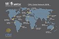 Cifal Global Network.jpg 1,950 × 1,291; 1.04 MB
 Cin res.png 220 × 220; 34 KB
 Clairemont Mesa community.pdf 1,275 × 1,650; 934 KB
 Cobham lake1.png 792 × 612; 747 KB
 CoE Growth.gif 1,600 × 1,018; 103 KB
 Colonia Battipaglia.jpg 1,156 × 787; 209 KB
 Colonie italiane.jpg 1,556 × 2,008; 401 KB
 Comandes Temple Conca Barberà.jpg 2,140 × 2,360; 199 KB
 Comitatûs Burgundiae.jpg 6,688 × 7,667; 17.69 MB
 Commonwealth of Independent States.png 120 × 120; 17 KB
 Communauté de communes de l'outre forêt.png 461 × 517; 28 KB
 Communauté de communes pays rhénan.png 461 × 517; 28 KB
 ConIFA WFC 2018 qualified teams.png 3,299 × 1,904; 23.97 MB
 Constantinople-HY.svg 500 × 400; 19 KB
 Cooch Behar district.png 800 × 1,132; 119 KB
 Countries that sanctioned Venezuela.svg 2,754 × 1,397; 218 KB
 Cph.png 513 × 480; 28 KB
 CSEE ZachWorld.png 4,096 × 4,096; 2.05 MB
 CustomNewEngland.png 640 × 952; 16 KB
 Cut Yamal Peninsula.jpg 297 × 446; 205 KB
 Das Mittelländische Meer Und Nord-Afrika (Westliches Blatt).jpg 5,771 × 4,795; 11.06 MB
 Das Mittelländische Meer Und Nord-Afrika.jpg 5,652 × 4,701; 10.51 MB
 Datos Generales Tunja.jpg 728 × 546; 48 KB
 Delfland, hoogheemraadschap (3381208975).jpg 2,000 × 1,727; 1.67 MB
 DensidadCNB.png 5,289 × 5,569; 557 KB
 Der Deutsche Rheinbund.jpg 8,028 × 6,839; 21.04 MB
 Der Leipziger Kreis.jpg 4,880 × 3,693; 5.8 MB
 Der Preussische Staat.jpg 6,939 × 5,832; 10.94 MB
 DESTINO IBERIA EUROPA.gif 720 × 360; 19 KB
 Destinos Iberia africa.gif 540 × 540; 14 KB
 Destinos Iberia asia.gif 720 × 360; 16 KB
 DESTINOS IBERIA ESPANA.gif 540 × 540; 14 KB
 DESTINOS IBERIA ESPAÑA.gif 540 × 540; 11 KB
 Detailvaarkaart.png 1,332 × 591; 105 KB
 Deutschland (physische Karte).jpg 10,171 × 8,263; 11.07 MB
 Deutschland Nach seiner neuesten Grenz-berichtigung (2).jpg 9,974 × 7,106; 21.87 MB
 Deutschland Nach seiner neuesten Grenz-berichtigung.jpg 10,077 × 7,505; 22.55 MB
 Diagonal Seca.jpg 626 × 632; 321 KB
 Die Baierische Monarchie.jpg 10,876 × 12,616; 23.29 MB
 Die Britischen Inseln und die Nord-See.jpg 5,624 × 4,562; 7.85 MB
 Die Route durch Deutschland.jpg 846 × 591; 60 KB
 División administrativa Goicoechea.png 1,382 × 366; 95 KB
 DL Destionation Cuts.png 2,478 × 1,240; 1.13 MB
 Dlouhá cesta, Langweg, Praha. Zákres kapacitní komunikace, cca 1944.jpg 922 × 716; 224 KB
 Dlouhá cesta, Praha, 2. vojenské mapování.jpg 743 × 757; 139 KB
 Dlouhá cesta, Praha, městský regulační plán 1938.jpg 885 × 794; 193 KB
 Dlouhá cesta, Praha, městský regulační plán 1964.jpg 961 × 762; 192 KB
 Ducatus Mediolani una cum Confinÿs accurata Tabula.jpg 7,728 × 6,567; 19.36 MB
 Dænmerk.png 230 × 194; 12 KB
 EAR-ONS-"Punishment" map.png 1,024 × 767; 1.31 MB
 Easy map - A link with custom text.png 494 × 421; 157 KB
 Easy map - Just a link with coordinates.png 493 × 418; 159 KB
 Easy map - more details.png 491 × 633; 120 KB
 Edelmann Standorte.jpg 7,939 × 5,005; 4.66 MB
 Efisgan Senate (2016 -2018).svg 360 × 185; 6 KB
 Eix pirinenc.png 243 × 187; 9 KB
 England Und Wales.jpg 5,656 × 4,548; 7.97 MB
 Engº Sande de Vasconcelos - Planta do Fortaleza de Cacela.png 784 × 296; 315 KB
 Enlargement of top of map.png 180 × 205; 85 KB


.png)


%27_(11249974424).jpg)


.jpg)


.jpg)


_(14597191349).jpg)
_(14803710993).jpg)


_1886.png)


.svg)


.png)
.jpg)


_v%C9%99_Qalaqay%C4%B1n_(Cellan).png)


.jpg)


.jpg)


.jpg)
.jpg)
.jpg)


.svg)


