Category:Montana
Jump to navigation
Jump to search

- States of the United States
- Alabama
- Alaska
- Arizona
- Arkansas
- California
- Colorado
- Connecticut
- Delaware
- Florida
- Georgia
- Hawaii
- Idaho
- Illinois
- Indiana
- Iowa
- Kansas
- Kentucky
- Louisiana
- Maine
- Maryland
- Massachusetts
- Michigan
- Minnesota
- Mississippi
- Missouri
- Montana
- Nebraska
- Nevada
- New Hampshire
- New Jersey
- New Mexico
- New York
- North Carolina
- North Dakota
- Ohio
- Oklahoma
- Oregon
- Pennsylvania
- Rhode Island
- South Carolina
- South Dakota
- Tennessee
- Texas
- Utah
- Vermont
- Virginia
- Washington
- West Virginia
- Wisconsin
- Wyoming
- District of Columbia
- Washington, D.C.
  state of the United States of America | |||||
| Instance of | state of the United States | ||||
| Part of | contiguous United States | ||||
| Named after | |||||
| Location | |||||
| Capital | |||||
| Legislative body |
| ||||
| Executive body |
| ||||
| Highest judicial authority |
| ||||
| Official language | |||||
| Head of government | |||||
| Inception | 8 November 1889 | ||||
| Population |
| ||||
| Area |
| ||||
| Elevation above sea level |
| ||||
| official website | |||||
| |||||
|
|
|||||
Subcategories
This category has the following 32 subcategories, out of 32 total.
A
B
C
D
E
F
G
H
L
M
N
O
P
S
T
V
Τ
Media in category "Montana"
The following 56 files are in this category, out of 56 total.
 A view of the wall directly facing west..jpg 4,032 × 3,024; 3.89 MB
 Bell Cross Ranch.jpg 4,160 × 3,120; 3.07 MB
 Fire vs Ice - panoramio.jpg 3,264 × 2,448; 725 KB
 Fort Buford Military Reservation, North Dakota and Montana.jpg 534 × 736; 215 KB
 Fort Campbell in 1865. A trading post in Montana.jpg 687 × 396; 86 KB
 Fosilie edmontosaura Montana.jpg 1,500 × 1,125; 333 KB
 From Dawson Pass to the South - panoramio.jpg 2,592 × 1,936; 2.25 MB
 Furbearing animal Pelts.jpg 6,000 × 4,000; 21.76 MB
 Griz in Car.jpg 2,464 × 1,632; 796 KB
 Griz Rubber Bullet 2.jpg 2,464 × 1,632; 661 KB
 Griz Rubber Bullet.jpg 1,954 × 966; 320 KB
 Griz YNP.jpg 2,464 × 1,632; 692 KB
 Heading S through Montana Hwys 83-200-141-I-90-I-15 - (28697315146).jpg 5,616 × 3,744; 11.7 MB
 Heading S through Montana Hwys 83-200-141-I-90-I-15 - (28729555465).jpg 5,269 × 3,513; 14.67 MB
 Heading S through Montana Hwys 83-200-141-I-90-I-15 - (28729561525).jpg 5,164 × 3,443; 6.85 MB
 Heart Butte Tree.JPG 3,648 × 2,736; 2.41 MB
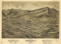 Helena (Montana) 1875.png 2,148 × 1,556; 6.19 MB
 Helena (Montana) 1883.png 2,100 × 1,276; 4.32 MB
 Helena (Montana) 1890.png 3,144 × 2,088; 11.46 MB
 Hell Creek State Park.jpg 1,500 × 1,125; 256 KB
 Hidden Lake Lookout.JPG 4,899 × 2,829; 4.01 MB
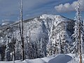
 Hilgard Peak.jpg 2,038 × 1,213; 447 KB
 Howe Ridge Fire.png 2,486 × 1,390; 4.59 MB
 La Moubra - panoramio.jpg 1,080 × 717; 618 KB
 Looking across to Idaho - panoramio.jpg 3,264 × 2,448; 2.33 MB
 Looking straight up at Lone Peak... - panoramio.jpg 3,520 × 1,424; 1.07 MB
 Madison Valley (East of Cliff Lake), Montana - panoramio.jpg 2,552 × 1,912; 1.96 MB
 MIA-YVR aerial shots - looking N to Canada from Montana - (19345589071).jpg 2,942 × 1,961; 4.92 MB
 Microwave With Cryo-Platform (8531580592).jpg 240 × 166; 20 KB
 Military Reservation of Camp Baker.png 1,382 × 2,451; 3.1 MB
 Montana Badlands.jpg 1,500 × 1,125; 195 KB
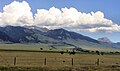
 Montana farmland.jpg 2,016 × 1,179; 612 KB
 Montana Rock Creek Trailhead.jpg 6,000 × 4,000; 8.27 MB
 October Sky - panoramio.jpg 9,961 × 3,385; 13.75 MB
 Old plow (16171466841).jpg 4,259 × 2,910; 13 MB
 On the Lift at Big Sky Resort - panoramio.jpg 3,264 × 2,448; 1.72 MB
 Parking lot at Lookout Pass - panoramio.jpg 3,264 × 2,448; 1.63 MB
 Perched (16677352530).jpg 2,000 × 1,333; 2.04 MB
 Placid Lake.jpg 1,280 × 800; 366 KB
 Placidsmoky.jpg 1,280 × 753; 262 KB
 Road to the Unknown - panoramio.jpg 4,587 × 2,546; 5.72 MB
 Running through blue (16912790599).jpg 2,400 × 3,600; 768 KB
 Russellwestonhome.jpg 768 × 512; 88 KB
 Sawtooth mountains - panoramio.jpg 2,560 × 1,920; 1.52 MB
 Spring break powder at Discovery - panoramio.jpg 3,072 × 2,304; 1.5 MB
 Summer Snow - panoramio.jpg 3,264 × 2,448; 1.11 MB
 Surveying close to Wolf Point 1978 - panoramio.jpg 958 × 676; 334 KB
 Swans over Lower Red Rock Lake (6531264313).jpg 1,024 × 654; 326 KB
 The Rockies from the E. NW Montana (16147578646).jpg 5,487 × 3,658; 14.73 MB
 Top of the World - panoramio.jpg 3,264 × 2,448; 1.48 MB
 Up the lift to Lone Peak - panoramio.jpg 1,600 × 1,200; 471 KB
 USA Montana relief location map.jpg 2,689 × 2,000; 3.44 MB
 View of the Wall from Prairie Reef Lookout.jpg 4,032 × 3,024; 1.92 MB
 Weeds63 (27298707359).jpg 2,722 × 1,930; 5.83 MB


.jpg)
.jpg)
.jpg)

_1875.png)
_1883.png)
_1890.png)


,_Montana_-_panoramio.jpg)
.jpg)
.jpg)


.jpg)
.jpg)


.jpg)


_(14761148792).jpg)

.jpg)


.jpg)
.jpg)


.jpg)