File:Arlington County - Virginia.jpg
Jump to navigation
Jump to search


Size of this preview: 800 × 529 pixels. Other resolutions: 320 × 212 pixels | 640 × 424 pixels | 896 × 593 pixels.
Original file (896 × 593 pixels, file size: 677 KB, MIME type: image/jpeg)
Summary[edit]
| Description |
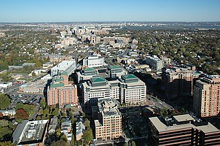
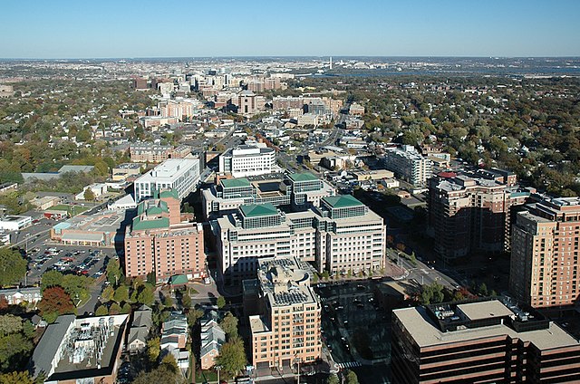
English: View of the central urbanized axis, developed along the Fairfax Drive and Clarendon Boulevard in Arlington County, Virginia, USA. The axis is long approximately 3 miles (4.5 km) and is figuratively perpendicular to the Potomac River which separates the county from the city of Washington. The Washington Monument obelisk is clearly visible in the background.
|
| Date | |
| Source | https://www.flickr.com/photos/arlingtonva/5221498943/in/photostream/ |
| Author |
|
| Camera location | | View this and other nearby images on: OpenStreetMap - Google Earth |
|---|
Licensing[edit]
| This image, originally posted to Flickr, was reviewed on by the administrator or reviewer Sreejithk2000, who confirmed that it was available on Flickr under the stated license on that date. |
|
This file is licensed under the Creative Commons Attribution-Share Alike 2.0 Generic license. | |
|
| Annotations | This image is annotated: View the annotations at Commons |


|
This image has been assessed under the valued image criteria and is considered the most valued image on Commons within the scope: Arlington County urban center, Virginia. You can see its nomination here. |
File history
Click on a date/time to view the file as it appeared at that time.
| Date/Time | Thumbnail | Dimensions | User | Comment | |
|---|---|---|---|---|---|
| current | 15:11, 5 March 2012 | | 896 × 593 (677 KB) | MrPanyGoff (talk | contribs) | more broghtness |
| 15:09, 5 March 2012 |  | 896 × 593 (654 KB) | MrPanyGoff (talk | contribs) |
- You cannot overwrite this file.
File usage on Commons
The following 4 pages uses this file:
File usage on other wikis
The following other wikis use this file:
- Usage on cs.wikipedia.org
- Usage on en.wikipedia.org
- Usage on fi.wikipedia.org
- Usage on hu.wikipedia.org