File:Baton Lartet MHNT PRE .2010.0.1.2 Global noir.jpg
Jump to navigation
Jump to search


Size of this preview: 800 × 401 pixels. Other resolutions: 320 × 160 pixels | 640 × 321 pixels | 1,024 × 513 pixels | 1,280 × 641 pixels | 11,160 × 5,592 pixels.
Original file (11,160 × 5,592 pixels, file size: 9.26 MB, MIME type: image/jpeg)
| Warning | The original file has a large number of pixels and when opened at full resolution, may either not load properly or cause your browser to freeze. These problems can be avoided by use of the ZoomViewer.
|
|---|
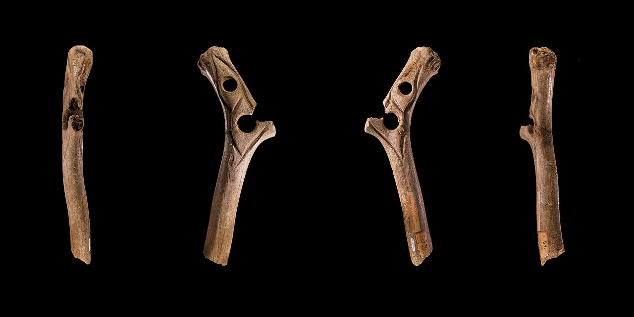
Pierced rod, La Madeleine, Dordogne, France
| Description |
English: Pierced rod in length of antler
Français : Bâton percé en bois de cervidé
|
|||||
| Date | ||||||
| Source | Own work | |||||
| Author | Didier Descouens | |||||
| Permission (Reusing this file) |
I, the copyright holder of this work, hereby publish it under the following license:
|
|||||
| Other versions |
|


| Camera location | | View this and other nearby images on: OpenStreetMap - Google Earth |
|---|

|
This document was made as part of the Projet Phoebus.
|

|
This image has been assessed under the valued image criteria and is considered the most valued image on Commons within the scope: Bâton de commandement. You can see its nomination here. |
File history
Click on a date/time to view the file as it appeared at that time.
| Date/Time | Thumbnail | Dimensions | User | Comment | |
|---|---|---|---|---|---|
| current | 13:50, 28 July 2010 | | 11,160 × 5,592 (9.26 MB) | Archaeodontosaurus (talk | contribs) | {{Information |Description={{en|1=1}} {{fr|1=0}} |Source={{own}} |Author=Archaeodontosaurus |Date= |Permission= |other_versions= }} |
- You cannot overwrite this file.
File usage on Commons
The following 11 pages uses this file:
- User:Jean-Frédéric/WmFr2010/07
- User talk:Archaeodontosaurus/Printemps-Eté 2010
- Commons:Projet Phoebus/Valued images
- Commons:Valued image candidates/Baton Lartet MHNT PRE .2010.0.1.2 Global noir.jpg
- Commons:Valued images by topic/Objects/Other
- File:Baton Lartet MHNT PRE .2010.0.1.2 Global fond.jpg
- File:Baton Lartet MHNT PRE .2010.0.1.2 Global noir.jpg
- File:Baton Lartet MHNT PRE .2010.0.1.2 Seul Fond.jpg
- File:Baton Lartet MHNT PRE .2010.0.1.2 Seul noir.jpg
- Category:Bâton de commandement
- Category:Bâton percé from the Abri de la Madeleine, France - MHNT PRE.2010.0.1.2
File usage on other wikis
The following other wikis use this file:
- Usage on ca.wikipedia.org
- Usage on de.wikipedia.org
- Usage on en.wikipedia.org
- Usage on es.wikipedia.org
- Usage on fi.wikipedia.org
- Usage on fr.wikipedia.org
- Usage on hu.wikipedia.org
- Usage on it.wikipedia.org
- Usage on no.wikipedia.org
- Usage on pl.wikipedia.org
- Usage on sv.wikipedia.org