File:Ciurana.jpg

This is a photo of a historical place indexed in the Spanish heritage register of Bienes de Interés Cultural under the reference RI-54-0000013. |
|

|
This image has been assessed under the valued image criteria and is considered the most valued image on Commons within the scope: Siurana. You can see its nomination here. |
|
Summary[edit]
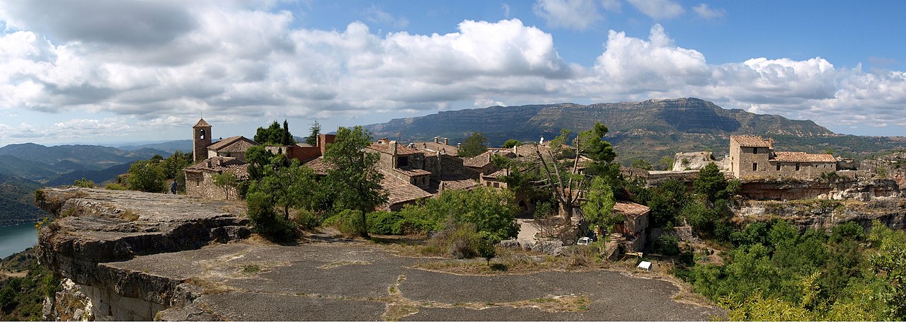
| Description |
Español: Siurana, o Siurana de Prades es una localidad de la provincia de Tarragona, Cataluña, España. Es un agregado del municipio de Cornudella de Montsant, en la parte más baja de la Sierra de la Gritella, en la comarca del Priorato en Tarragona.
English: Panoramic view of Siurana, Catalonia, Spain
Français : Vue panoramique de la commune de Siurana, Province de Tarragona, Catalogne, Espagne.
|
||
| Date | |||
| Source | Own work | ||
| Author | Elemaki | ||
| Permission (Reusing this file) |
|

| Object location | | View this and other nearby images on: OpenStreetMap - Google Earth |
|---|
Licensing[edit]

|
Permission is granted to copy, distribute and/or modify this document under the terms of the GNU Free Documentation License, Version 1.2 or any later version published by the Free Software Foundation; with no Invariant Sections, no Front-Cover Texts, and no Back-Cover Texts. A copy of the license is included in the section entitled GNU Free Documentation License. |
| This file is licensed under the Creative Commons Attribution 3.0 Unported license. | ||
|
File history
Click on a date/time to view the file as it appeared at that time.
| Date/Time | Thumbnail | Dimensions | User | Comment | |
|---|---|---|---|---|---|
| current | 21:27, 18 September 2009 | 5,244 × 1,865 (2.12 MB) | Elemaki (talk | contribs) | {{Information |Description={{es|1=Panorámica del municipio de Ciurana, de la comarca del Alto Ampurdán (provincia de Gerona, España)}} |Source=Own work |Author=Elemaki |Date=6 de septiembre de 2009 |Permission= |other_versions= }} |
- You cannot overwrite this file.
File usage on Commons
The following 7 pages uses this file:
File usage on other wikis
The following other wikis use this file:
- Usage on ca.wikipedia.org
- Usage on en.wikipedia.org
- Usage on es.wikipedia.org
- Priorato (Cataluña)
- Ciurana de Tarragona
- Pueblo (población rural)
- Wikipedia:Imágenes destacadas/Lugares/Europa
- Wikipedia:Recurso del día/401 - 500
- Wikipedia:Candidatos a recursos destacados/Ciurana.jpg
- Wikipedia:Candidatos a recursos destacados/Octubre-2009
- Plantilla:RDD/417
- Wikipedia:Recurso del día/noviembre de 2009
- Wikipedia:Recurso del día/febrero de 2011
- Anexo:Bienes de interés cultural de la comarca del Priorato (provincia de Tarragona)
- Wikipedia:Recurso del día/septiembre de 2012
- Wikipedia:Recurso del día/septiembre de 2014
- Wikipedia:Recurso del día/febrero de 2017
- Usage on fr.wikipedia.org
- Usage on hy.wikipedia.org
- Usage on ru.wikipedia.org
- Usage on vi.wikipedia.org
- Usage on www.wikidata.org