File:Commons geocoding.svg
Jump to navigation
Jump to search


Size of this PNG preview of this SVG file: 800 × 600 pixels. Other resolutions: 320 × 240 pixels | 640 × 480 pixels | 1,024 × 768 pixels | 1,280 × 960 pixels.
Original file (SVG file, nominally 800 × 600 pixels, file size: 21 KB)
| Description |
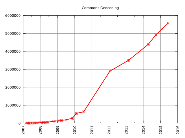
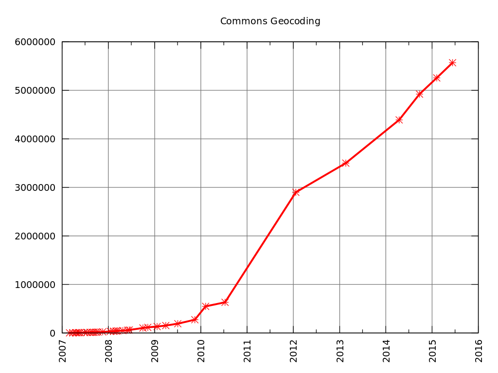
Deutsch: die Entwicklung der Anzahl georeferenzierter Bilder auf Commons
English: Graph of the amount of geocoded images on Commons
|
|||||
| Date | ||||||
| Source | Own work, data from File talk:Commons geocoding graph.svg | |||||
| Author | Kopiersperre | |||||
| Permission (Reusing this file) |
|
|||||
| SVG development |
Time data code
|
|||||
File history
Click on a date/time to view the file as it appeared at that time.
| Date/Time | Thumbnail | Dimensions | User | Comment | |
|---|---|---|---|---|---|
| current | 14:01, 27 June 2015 | | 800 × 600 (21 KB) | Kopiersperre (talk | contribs) | {{Information |Description={{de|die Entwicklung der Anzahl georeferenzierter Bilder auf Commons}} {{en|Graph of the amount of geocoded images on Commons}} |Source={{Own}}, data from [[File talk:Common... |
- You cannot overwrite this file.
File usage on Commons
The following 4 pages uses this file:
File usage on other wikis
The following other wikis use this file:
- Usage on de.wikipedia.org