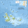
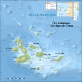
File:Galapagos Islands topographic map-fr.png
Jump to navigation
Jump to search


Size of this preview: 600 × 600 pixels. Other resolutions: 240 × 240 pixels | 480 × 480 pixels | 768 × 768 pixels | 1,024 × 1,024 pixels | 2,160 × 2,160 pixels.
Original file (2,160 √ó 2,160 pixels, file size: 2.14 MB, MIME type: image/png)
Summary[edit]
| Camera location | | View this and other nearby images on: OpenStreetMap - Google Earth |
|---|
| Description |
|
||
| Date | |||
| Source | Own work
|
||
| Author | Eric Gaba (Sting - fr:Sting) | ||
| Permission (Reusing this file) |
|
||
| Other versions |
[] |
Licensing[edit]
I, the copyright holder of this work, hereby publish it under the following licenses:

|
Permission is granted to copy, distribute and/or modify this document under the terms of the GNU Free Documentation License, Version 1.2 or any later version published by the Free Software Foundation; with no Invariant Sections, no Front-Cover Texts, and no Back-Cover Texts. A copy of the license is included in the section entitled GNU Free Documentation License. |
|
This file is licensed under the Creative Commons Attribution-Share Alike 4.0 International, 3.0 Unported, 2.5 Generic, 2.0 Generic and 1.0 Generic license. | |
|
You may select the license of your choice.
File history
Click on a date/time to view the file as it appeared at that time.
| Date/Time | Thumbnail | Dimensions | User | Comment | |
|---|---|---|---|---|---|
| current | 00:34, 20 July 2010 |  | 2,160 × 2,160 (2.14 MB) | Sting (talk | contribs) | Reverted to version as of 14:35, 19 July 2010 : test ended |
| 00:28, 20 July 2010 |  | 2,160 × 2,160 (4.3 MB) | Sting (talk | contribs) | sRGB converted (just for test) | |
| 14:35, 19 July 2010 |  | 2,160 × 2,160 (2.14 MB) | Sting (talk | contribs) | Color profile | |
| 14:37, 17 November 2009 |  | 2,160 × 2,160 (2.14 MB) | Sting (talk | contribs) | Embedded sRGB profile | |
| 12:52, 3 November 2008 |  | 2,160 × 2,160 (2.06 MB) | Sting (talk | contribs) | Corrections | |
| 01:35, 5 July 2008 |  | 2,160 × 2,160 (2.06 MB) | Sting (talk | contribs) | Oups ! | |
| 01:19, 5 July 2008 |  | 2,160 × 2,160 (2.07 MB) | Sting (talk | contribs) | Several little improvements | |
| 02:17, 3 July 2008 |  | 2,160 × 2,160 (1.87 MB) | Sting (talk | contribs) | == Summary == {{Location|00|30|00|S|90|30|00|W|scale:1000000}} <br/>{{Information |Description={{en|Topographic and bathymetric map of the Galápagos Islands, Ecuador.}} {{fr|Carte topographique et bathymétrique |
- You cannot overwrite this file.
File usage on Commons
The following 17 pages uses this file:
- Atlas of the Gal√°pagos Islands
- User:Nightingale/Working Area/ÁĒĽŚÉŹšļčšĺčťõÜ
- User:Nightingale/Working Area/ŤĘęŚÜôšĹ•ŤĎóšĹúś®©„Éę„Éľ„Éę
- User:Sting/Gallery: Regional maps
- Commons:Copyright rules by subject matter
- Commons:Copyright rules by subject matter/fa
- Commons:Copyright rules by subject matter/fr
- File:Galapagos Islands topographic map-blank.svg
- File:Galapagos Islands topographic map-blank (2).png
- File:Galapagos Islands topographic map-de.svg
- File:Galapagos Islands topographic map-en.svg
- File:Galapagos Islands topographic map-fr.png
- File:Galapagos Islands topographic map-fr.svg
- File:Galapagos Islands topographic map-mk.svg
- File:Galapagos Islands topographic map be.svg
- Template:Other versions/Galapagos Islands topographic map
- Help:Cartography
File usage on other wikis
The following other wikis use this file:
- Usage on en.wikipedia.org
- Usage on fr.wikipedia.org
- Usage on fr.wiktionary.org
- Usage on hu.wikipedia.org


