Old maps
Old maps are included in the ![]() Wikimedia Atlas
Wikimedia Atlas ![]() . The maps below should be included in the atlas.
. The maps below should be included in the atlas.
- For old maps of cities, see Old maps of cities.
- For maps showing history, see Maps showing history.
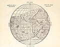
World maps[edit]

World map of Waldseemüller, which first used the name America, 1507

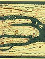
Ebstorfer world map

World map from the Middle Ages
Part of Tabula Peutingeriana

from Hartmann Schedels Worldchronic (1493)

World map by Johannes Kepler

Al-Idrisi's world map

Laurent Fries world map, 1522

Pedro de Medina & G.B. Pedrazano, 1554

by Jacques de Vaux (1583)
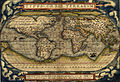
Ortelius world map (1570)

Oronce Fine(1536)

by Samuel de Champlain (1567?-1635)

by Jean Guérard (1627)

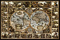
By Joan Blaeu (1664)
Magna Carta Mundi (1670)

Capt Dampier's new voyage to New Holland (1699)

by Philippe Buache (1737)

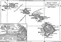
by Pîrî Reîs

by Pîrî Reîs
Historical map of the international dateline

Antique World Map with magnetic declination by Leonhard Euler (1753)
(1902-1924)

Map of Asia with Finnish text from "Pieni Tietosanakirja" (1925)


.jpg)
.jpg)


See also[edit]
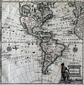
The Americas[edit]

Map of America by Sebastian Munster. 1561

Map of South America by Girolamo Ruscelli 1562
Map of America by Giovanni Battista Ramusio. 1565
Historical map of South America (1750)
Historical map of America. Ca. 1770

Historical map of the USA, Mexico and Central-America

Map of North and South America, French (18th century)

Mapa geographica completens Indiae Occidentalis


.jpg)


Caribbean and Central America[edit]

Barbados (1817)

Historical map of Central America (1860)

Historical map of Central America (1888)
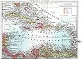
Antilles. Map from the Brockhaus and Efron Encyclopedic Dictionary, 1890-1907
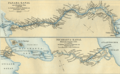
Historical map of the proposed Panama and Nicaragua canals


North America[edit]

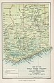
Western part of the USA
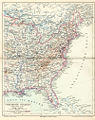
Eastern part of the USA
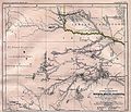
Captain Marcy's route though Texas (1854)

Oregon Trail (1907)
Historical map of the Hawaii-archipelago

Map of New Netherland and New England (around 1685)

New Holland map by William Dampier (1699)

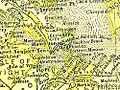
Milton County, Georgia (1883)
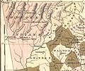
Cherokee lands (1822)

Cherokee counties (1834)
Elizabeth City County (1895)

Norfolk County, Virginia (1895)

Princess Anne County, Virginia (1895)
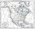
North America (1797)

Map of "Greater America" (1899)

by Claude Bernou (16..-17..?)

Nova Belgica et Anglia Nova (1635)


.jpg)


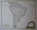
South America[edit]
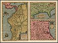
Map of Peru by Abraham Ortelius, 1608.
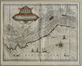
Historical map of Peru (1635)

Map of Peru. (1647). By Ioannem Ianssonium. (1558-1664).

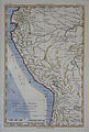
Map of Peru by Nicolas Sanson d'Abbeville (1600-1667)

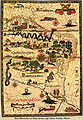
Map of Peru and the Amazonas River by Nicolas Sanson d'Abbeville (1600-1667)

Map of Peru by Nicolas Sanson d'Abbeville (1600-1667)

Map of Peru. 1683. French version

Map of Peru. 1683. Das Königreich Perou

Historical map of Peru by Herman Moll. Ca. 1720

Historical map of Peru by Emanuel Bowen. Ca. 1750

Historical map of Peru by Benard. Ca. 1750
Historical map of Peru by Rigobert Bonne. Ca. 1780
Historical map of South America by Diogo Homem. Ca 1558


.JPG)


Europe[edit]

Leo Belgicus - map of the Low Countries (1611)

Leo Belgicus by P. Kaerius & Hendrik Floris van Langren (1617)

Historical map of the Bay of Bajä (1888)

Historical map of the Stait of Messina (1888)
Historical map of Cyprus (1888)

Historical map of Madeira (1888)
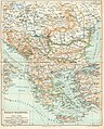
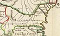
Historical map of the Balkan peninsula (1888)

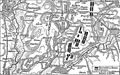
Historical map of the Balkans War Theatre during the First Balkan War (1912-13)
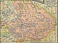
Historical map of the Kingdom of Hungary (1888)
Historical map of the Isle of Corsica (1888)

Historical map of Iceland (1888)

Straßenkarte für Rompilger (Erhard Etzlaub, um 1500)

Historical map of the area surrounding Toulon (1888)

Europe at the death of Charlemagne in 814
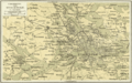
Eastern Europe (1836)

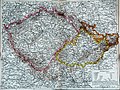
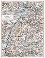
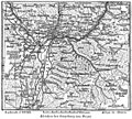
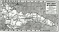
Historical map of Switzerland 1291-1515 (1912)

Historical map of Switzerland 1291-1515 (1912)
[technical revised version]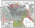
Ottoman Empire, 1481-1683 (1923)

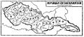
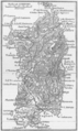
Carniola before 1900

Route of the leaders of the first Crusade (1911)
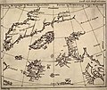
The Zeno Map (1558)

Carte ancienne de la Nouvelle-Zemble

Map of Europe with Finnish text from "Pieni Tietosanakirja" (1925)
Canary Islands map by William Dampier (1699)


.jpg)


.jpg)


Austria[edit]

Karte Oberösterreichs. Archiducatus Austriae Superioris Descriptio facta Anno 1667. Georg Matthäus Vischer, erschienen 1669

Historical map of the area surrounding Bad Ischl (1888)

Historical map of the area surrounding Innsbruck (1888)

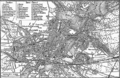
Historical map of the area surrounding Vienna (1888)

Historical map of Tyrol

Historische Karte des oberösterreichischen Innviertels (1779)


.jpg)

.jpg)
Bulgaria[edit]

Atlas sive Cosmographicae Meditationes de Fabrica Mundi et Fabricati Fugura
Imperii Orientalis et Circumjacentium Regionum, sub Constantino Porphyrogenito et ejus praedecessoribus descriptio. (Paris : Guillelmo Del'Isle, 1715?).

Bulgaria after the Conference of Constantinople 1876-1877

Map of railway lines of Bulgaria (1877-1878)

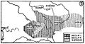
A map of the Principality of Bulgaria and Eastern Rumelia before the unification of Bulgaria in 1885. The map is from an 1882 atlas

Mapa del principado de Bulgaria tras 1885, con la anexión de Rumelia oriental

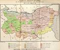
Map of Bulgaria (1885)
Ethnic map of Bulgaria, according to the census from 1892

Bulgarien, alte Schulkarte; um 1922

Bulgaria during World War I
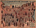
Map of National costume of Bulgaria
_267.jpg)
.jpg)


.jpg)
_1892.JPG)


Czech Republic[edit]

Historical map of Great Moravia under the rule of Svatopluk
Historical map of the Czech state in the 10th century under the rule of Boleslav I. and Boleslav II.

Historical map of the Czech Lands and other lands ruled by the King of Bohemia (turn of the 14th century)
Historical map of the Kingdom of Bohemia during the Hussite Wars (1419-34)

Historical map of the Czech Lands (14th century - 1742)

Historical map of the Czech Lands and other lands ruled by the King of Bohemia (reign of John of Bohemia)

Historical map of the Czech Lands and other lands ruled by the King of Bohemia (second half of the 14th century)

Historical map of the Czech Lands and other lands ruled by the King of Bohemia (beginning of the Thirty Years War)

Historical map of the Czech Lands as a part of the Habsburg ruled territories (16th century)

Historical map of the Czech Lands (from the half of the 18th century to the First World War)
Historical map of the Czech Lands (1892)

Historical map of the Czech lands and Slovakia (published in exile magazine La Nation Tchèque during the First World War)

Historical map of the Czech lands within the first Czechoslovak Republic in 1919 (published in Czech daily 'Svornost' in Chicago)
Historical map of the Czech lands within the first Czechoslovak Republic until 1928 (in 1928 Moravia and Czech Silesia were merged into one administrative unit - the Moravian-Silesian Land)


France[edit]
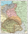
Germany[edit]

Magna Germania um 150 n. Chr. Kopie bzw. Rekonstruktion von Nicolaus Germanus (15. Jahrhundert) nach dem Text des Ptolemäus.

Grafschaft Mark (1681)

Upper Silesia (1746)

Grafschaft Mark (1791)
Harburg von 1757

Oberamt Ravensburg (1834)

Historical geological map of Thuringia (1888)

Historical map of the area surrounding Wiesbaden (1888)

Historical map of the area surrounding Stuttgart (1888)

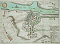
Historical map of the Kiel Canal (1888)

Historical map of Württemberg and Hohenzollern (1888)

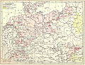
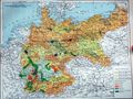
Administrative map of the German Empire (1900)

Historical map of Brandenburg (1903)

Historical map of Westphalia (1888)

Historical map of Heligoland (1888)

Historical map of the area surrounding Kiel
Historical map of the area surrounding Potsdam

Historical map of the German Empire: General industry, mines and smelting industry

Historical map, Population density 1881

Historical map of the German Empire: Population density

Historical map of the German Empire: Historical maps 1

Historical map of the German Empire: Historical maps 2
Historical map, Religions 1881
Historical map of the German Empire: Religious denomination

Ancient Germania (1849)
Historical map of the German Empire: Agriculture

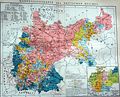
Historical map of the German Empire: Political map

Historical map of Prussia, before 1905
Baden before 1900

Rheinisch-Westfälischs Kohlen- und Industriegebiet (1886)

Province Saxony before 1918

Map of a part of North Rhine-Westphalia, (early 19th century) showing Ratingen, Wuppertal, Mülheim, Essen and Bochum

Map of a part of Hamburg (Altona)

Historical map of territorial losses (the areas in black) of Germany after the 1919 Treaty of Versailles


.jpg)


.jpg)


Italy[edit]
Historical map of area surrounding Bozen (1888)

Historical map of area surrounding Meran (1888)
Historical map of the Isle of Capri (1888)
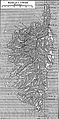
Historical map of the Isle of Sardinia (1888)

Historical map of La Spezia (1888)
Historical map of Trieste (1888)


See also[edit]
Poland[edit]
Upper Silesia (1746)

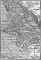
Western Governorships (of Russian Empire) and Polish Kingdom in 1902
 English: Hydrography of PolandPolski: Hydrografia Polski
 English: Historical MapPolski: Mapa historyczna
 English: Historical MapPolski: Mapa historyczna
 English: Historical MapPolski: Mapa historyczna
 English: Historical MapPolski: Mapa historyczna
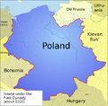 English: Historical MapPolski: Mapa historyczna
 English: Historical MapPolski: Mapa historyczna
 English: Historical MapPolski: Mapa historyczna
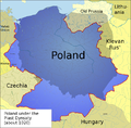 English: Historical MapPolski: Mapa historyczna
 English: Historical MapPolski: Mapa historyczna
Poland 1201-1241

Poland 1275-1300

Poland 1304-1333
Polish-Lithuanian Commonwealth in 17th and 18th century
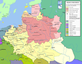
Polish-Lithuanian Commonwealth - administrative division

Poland in 1939

Poland between 1921 and 1939


.png)
.png)
.png)


Russia[edit]

Historical map of Russia (1725)

Historical map of the European part of Russia (1888)

Historical map of the Grand Duchy of Moscow (1888)

Historical map of the area surrounding St. Petersburg (1888)

Historical map of Russia

Historical map of Vladivostok when seized by the Czechoslovak Legions (29 June 1918)


.jpeg)


[edit]

Historical map of the area surrounding Copenhagen (1888)
Historical map of the area surrounding Stockholm (1888)


Slovakia[edit]

Historical map of Slovakia (1921)
New railways in Slovakia (1932)

Historical map of the Upper Váh Basin (1933)


Iberian Peninsula (Spain and Portugal)[edit]

Historical map of Spain (1850)


Turkey[edit]

History map of European Turkey

Historical map of the Bosporus


Gibraltar[edit]

Historical map of the promontory of Gibraltar (1888)

UK[edit]

Map of the County of Northumberland by Christopher & John Greenwood (1828)
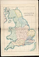
Britannia Saxonica (1833)

Saxon England according to the Saxon Chronicle (1830)

Britannia Saxonica (1695)


see also[edit]
Category:Old Ordnance Survey map images
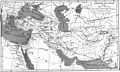
Middle East[edit]
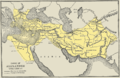
Map of the empire of Alexander the Great

Hartmann Schedel: DESTRVCCIO IHEROSOLIME (from the Liber cronicarum, Nuremberg 1493)

The oldest printed prospect of Jerusalem - By Hartmann Schedel, Nürnberg 1493 (from the Liber cronicarum)


Asia[edit]

Historical map of Central Asia

Historical map of the Crimean peninsula (1888)
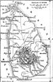
Historical map of Ceylon (Sri Lanka) (1888)
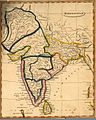
map of "Hindoostan" by Arrowsmith and Lewis (1812)
Tonking, Östl. Hinterindien, Hue, Ha-Noi
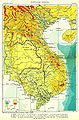
Map of French Indochina after the First World War
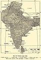
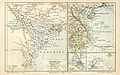
Political map of India after the First World War

Ethnographical map of High Asia in the beginning of 20th century
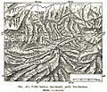
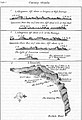
Old map of major glaciers of the Tian Shan
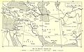
Map of railways in West Asia in the beginning of 20th century


China[edit]
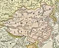
Chinese Empire (aka Qing Dynasty), 1892, from the Encyclopædia Britannica North American edition
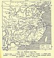
Political map of China after the First World War


Japan[edit]

map on 18th century
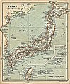
map on 1911


Korea[edit]
Taiwan[edit]

The first 'correct' map of Taiwan in the world, which was drawn by a Dutch sailor (1625)
The Island Formosa and the Pescadores by Johannes Vingboons (ca 1640)

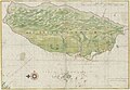
Historical map of Taiwan (1896)


Ryukyu[edit]
Oceania[edit]
Melanesia[edit]

Historical map of New Caledonia and the Loyalty Islands

Spanish/Portuguese map ca.1600 of New Guinea and the Malay Archipelago


Africa[edit]

Map of Africa (1508)

Africae tabula nova (1570)

Map of Africa (1910s)

Map of Africa (1890)

Map of Africa (1812)

Map of Eastern Africa (1829)

Historical map of Zanzibar (1888)

Historical map of Cameroun

Historical map of Madagascar (1888)

Historical map of the gulf of Aden (1888)
The Gold Coast and Ashanti Confederacy (1896)

Map of the Great Rift Valley (1931)


Special maps[edit]

Language world map (1888)

Declination world map (1888)

Weather map for Europe (09. & 10 Dec 1887)

Synoptic chart of Europe and the North Atlantic, October 1874.


War maps[edit]
Historical map of the campaign by Breitenfeld (17.09.1631)

Historical map of the campaign by Lützen (16.11.1632)

Historical map of the campaign by Fehrbellin (28.06.1675)

Historical map of the campaign by Höchstädt (13.08.1704)

Historical map of the campaign by Hohenfriedeberg (04.06.1745)

Historical map of the campaign by Kolin (18.06.1757)

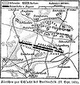
Historical map of the campaign by Roßbach(05.11.1757)

Historical map of the campaign by Leuthen(05.12.1757)

Historical map of the campaign by Hochkirch (14.10.1758)

Historical map of the campaign by Kunersdorf (12.08.1759)

Mannheim (1794)

Battle of Marengo (1800)
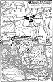
Historical map of the campaign by Austerlitz (02.12.1805)

Historical map of the campaign by Jena (14.10.1806)

Historical map of the campaign by Auerstädt (14.10.1806)
Historical map of the campaign by Aspern (12.05.1809)

Historical map of the campaign by Wagram (05. & 06.07.1809)

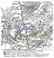
Historical map of the battle of the nations by Leipzig (16.10.1813)

Historical map of the battle of the nations by Leipzig (18.10.1813)
Historical map of the campaign by Waterloo (18.06.1815)

Historical map of the siege of Sevastopol (1854-1855)

Historical map of the campaign by Solferino (24.06.1859)

Battle of Pea Ridge (1862)

Historical map of the campaign by Königgrätz (03.07.1866)

Historical map of the campaign by Wörth(06.08.1870)

Historical map of the campaign by Sedan (01.09.1870)

Historical map of the campaign by Orléans (Dec 1870)
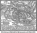
Historical map of the campaign by Plewen (11. & 12.09.1877)


.jpg)
.jpg)
.jpg)
.jpg)

.jpg)
.jpg)
.jpg)

.png)


.jpg)

.jpg)


.jpg)
.jpg)

.jpg)
.jpg)
.jpg)
.jpg)
.jpg)