File:Atmospheric terahertz transmittance at Mauna Kea (simulated).png
.png)
.png/750px-Atmospheric_terahertz_transmittance_at_Mauna_Kea_(simulated).png)
.png/300px-Atmospheric_terahertz_transmittance_at_Mauna_Kea_(simulated).png)
.png/600px-Atmospheric_terahertz_transmittance_at_Mauna_Kea_(simulated).png)
Contents
Summary[edit]
.png&action=edit§ion=1)
| Description |
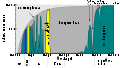
English: Plot of the zenith atmospheric transmission on the summit of Mauna Kea throughout a range of 1
to 3 THz at a precipitable water vapor level of 0.001 mm. Created using the CSO Atmospheric Transmission Interactive Plotter at the submillimeter wave astronomy site of en:caltech [1] |
| Date | (original upload date) |
| Source | Transferred from en.wikipedia to Commons. |
| Author | The original uploader was PNG crusade bot at English Wikipedia |
 |
This graph image could be recreated using vector graphics as an SVG file. This has several advantages; see Commons:Media for cleanup for more information. If an SVG form of this image is available, please upload it and afterwards replace this template with {{vector version available|new image name}}. |
Licensing[edit]
.png&action=edit§ion=2)
 |
Permission is granted to copy, distribute and/or modify this document under the terms of the GNU Free Documentation License, Version 1.2 or any later version published by the Free Software Foundation; with no Invariant Sections, no Front-Cover Texts, and no Back-Cover Texts. A copy of the license is included in the section entitled GNU Free Documentation License. Subject to disclaimers. |
| This file is licensed under the Creative Commons Attribution-Share Alike 3.0 Unported license. Subject to disclaimers. | ||
|
||
| This licensing tag was added to this file as part of the GFDL licensing update.
|
Original upload log[edit]
.png&action=edit§ion=3)
The original description page was here. All following user names refer to en.wikipedia.
.html?title=File:Atmospheric_terahertz_transmittance_at_Mauna_Kea_%28simulated%29.png)
- 2007-05-11 01:52 Remember the dot 850×680×8 (5836 bytes) Reverted to earlier revision
- 2007-05-09 23:31 Remember the dot 850×680×2 (4377 bytes) transparent background
- 2007-05-09 23:25 PNG crusade bot 850×680×8 (5836 bytes) {{ShouldBeSVG}} Plot of the zenith atmospheric transmission on the summit of Mauna Kea throughout a range of 1 to 3 THz at a precipitable water vapor level of 0.001 mm. Created using the CSO Atmospheric Transmission Interactive Plotter at the
Related images[edit]
.png&action=edit§ion=4)
-

Atmospheric absorption.
-
Atmospheric absorption in SVG
-

Atmospheric transmittance of infrared.
-
Atmospheric transmittance.
-
en:Solar irradiance spectrum.
-
.png/120px-Atmospheric_terahertz_transmittance_at_Mauna_Kea_(simulated).png)
Atmospheric terahertz transmittance at mauna kea(simulated)
Automatically converted to PNG[edit]
.png&action=edit§ion=5)
The PNG crusade bot automatically converted this image to the more efficient PNG format. The image was previously uploaded as "Atmospheric terahertz transmittance at Mauna Kea (simulated).png".
Original upload log[edit]
.png&action=edit§ion=6)
01:05:42, 14 February 2005 (UTC) . . Deglr6328 (Talk | Contribs) . . 850x680 (23,547 bytes) (Plot of the zenith atmospheric transmission on the summit of Mauna Kea throughout a range of 1 to 3 Thz at a precipitable water vapor level of 0.001 mm. Created using the CSO Atmospheric Transmission Interactive Plotter at the submillimeter wave astronomy)
Previous description history[edit]
.png&action=edit§ion=7)
13:53:20, 8 May 2007 (UTC) Joelholdsworth (Talk | Contribs) ({{BadGIF}})
17:23:14, 7 May 2007 (UTC) Cydebot (Talk | Contribs) m (Robot - Fixing GFDL tags project-wide per en:Wikipedia:GFDL standardization.)
00:55:31, 8 November 2005 (UTC) Cmdrjameson (Talk | Contribs) m (Fix THz capitalisation)
23:11:31, 18 August 2005 (UTC) Omegatron (Talk | Contribs)
01:05:42, 14 February 2005 (UTC) Deglr6328 (Talk | Contribs) (Plot of the zenith atmospheric transmission on the summit of Mauna Kea throughout a range of 1 to 3 Thz at a precipitable water vapor level of 0.001 mm. Created using the CSO Atmospheric Transmission Interactive Plotter at the submillimeter wave astronomy)
File history
Click on a date/time to view the file as it appeared at that time.
| Date/Time | Thumbnail | Dimensions | User | Comment | |
|---|---|---|---|---|---|
| current | 07:17, 17 January 2008 | | 850 × 680 (6 KB) | Mike Peel (talk | contribs) | {{Information |Description={{en|Plot of the zenith atmospheric transmission on the summit of Mauna Kea throughout a range of 1 to 3 THz at a precipitable water vapor level of 0.001 mm. Created using the CSO Atmospheric Transmission Interactive Plotter at |
- You cannot overwrite this file.
File usage on Commons
The following 2 pages link to this file:
File usage on other wikis
The following other wikis use this file:
- Usage on en.wikipedia.org
- Usage on en.wikiversity.org
- Usage on es.wikipedia.org
- Usage on fa.wikipedia.org
- Usage on fr.wikipedia.org
- Usage on hi.wikipedia.org
- Usage on it.wikipedia.org
- Usage on ja.wikipedia.org
- Usage on ko.wikipedia.org
- Usage on pa.wikipedia.org
- Usage on sr.wikipedia.org
- Usage on zh.wikipedia.org
.png&oldid=158450424)
.png&action=edit&redlink=1)
.png&action=edit)
.png&action=history)
.png&action=info)
.png&mobileaction=toggle_view_mobile)