Category:Town hall in Bystrzyca Kłodzka
Jump to navigation
Jump to search
 This is a category related to an object of cultural heritage inscribed in the registry of the Lower Silesian Voivodeship with number A/1064 z 21.05.2008.

| Object location | | View all coordinates using: OpenStreetMap - Google Earth - Proximityrama |
|---|
This is a category about a monument in Poland identified by the ID 592402
|
 | |||||
| Instance of | city hall | ||||
| Location | Bystrzyca Kłodzka, Gmina Bystrzyca Kłodzka, Kłodzko County, Lower Silesian Voivodeship, Poland | ||||
| Heritage designation | |||||
| |||||
|
|
|||||
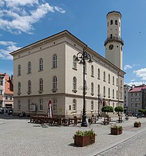
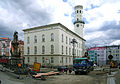
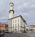
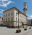
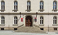
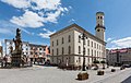
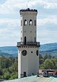
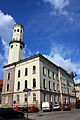
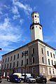
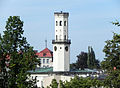
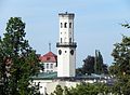
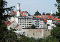
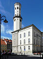
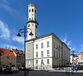
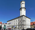
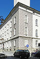
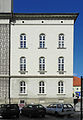
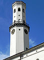
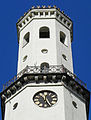
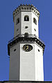
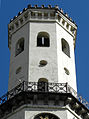
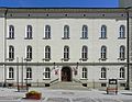
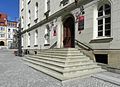
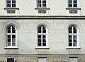
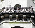
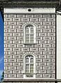
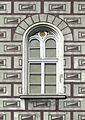
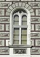
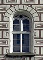
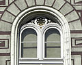
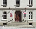
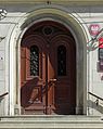
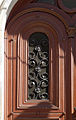
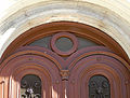
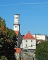
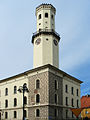
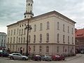
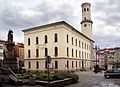
English: Town hall (1852-1854) - Bystrzyca Kłodzka, Lower Silesian Voivodeship, Poland.
Deutsch: Rathaus (1852-1854) in Bystrzyca Kłodzka, deutsch Habelschwerdt, Niederschlesien, Polen. Neo-Renaissance-Stil. Der Rathausturm ist ein Rest des früheren, durch Feuersbrunst zerstörten Renaissance-Rathauses.
Media in category "Town hall in Bystrzyca Kłodzka"
The following 47 files are in this category, out of 47 total.
 Bystrzyca Kłodzka. Ratusz.JPG 3,492 × 2,442; 1.99 MB
 2014 Ratusz w Bystrzycy Kłodzkiej.JPG 2,230 × 2,392; 2.67 MB
 2015 Ratusz w Bystrzycy Kłodzkiej 01.JPG 2,922 × 3,129; 5.69 MB
 2015 Ratusz w Bystrzycy Kłodzkiej 02.JPG 4,256 × 2,601; 6.42 MB
 2015 Rynek w Bystrzycy Kłodzkiej 01.JPG 3,772 × 2,385; 5.82 MB
 2016 Wieża ratusza w Bystrzycy Kłodzkiej.jpg 3,154 × 4,532; 6.6 MB
 592402 Bystrzyca Kłodzka Ratusz 01.JPG 2,848 × 4,272; 5.61 MB
 592402 Bystrzyca Kłodzka Ratusz 02.JPG 2,848 × 4,272; 5.71 MB
- 8197viki Bystrzyca Kłodzka. Foto BMaliszewska.jpg 2,000 × 1,445; 298 KB
 Bystrzyca 023.jpg 3,648 × 2,736; 2.5 MB
 Bystrzyca 025.jpg 3,648 × 2,736; 2.54 MB
 Bystrzyca 048.jpg 3,648 × 2,736; 2.45 MB
.jpg/120px-Bystrzyca_K%c5%82odzka%2c_ratusz_(Habelschwerdt).jpg) Bystrzyca Kłodzka, ratusz (Habelschwerdt).jpg 1,972 × 1,460; 804 KB
Bystrzyca Kłodzka, ratusz (Habelschwerdt).jpg 1,972 × 1,460; 804 KB
- Bystrzyca Kłodzka, Ratusz - fotopolska.eu (185920).jpg 803 × 1,200; 199 KB
 Bystrzyca Kłodzka, ratusz, 01.JPG 3,543 × 2,598; 4.72 MB
 Bystrzyca Kłodzka, ratusz, 02.JPG 2,316 × 1,698; 2.5 MB
 Bystrzyca Kłodzka, ratusz, 03.JPG 3,528 × 2,476; 4.53 MB
 Bystrzyca Kłodzka, ratusz, 04.JPG 2,121 × 2,902; 2.94 MB
 Bystrzyca Kłodzka, ratusz, 05.JPG 2,984 × 2,736; 4.29 MB
 Bystrzyca Kłodzka, ratusz, 06.JPG 2,838 × 2,467; 3.14 MB
 Bystrzyca Kłodzka, ratusz, 07.JPG 2,436 × 3,510; 4.66 MB
 Bystrzyca Kłodzka, ratusz, 08.JPG 2,526 × 3,648; 4.18 MB
 Bystrzyca Kłodzka, ratusz, 09.JPG 2,553 × 3,479; 3.89 MB
 Bystrzyca Kłodzka, ratusz, 10.JPG 2,682 × 3,546; 4.36 MB
 Bystrzyca Kłodzka, ratusz, 11.JPG 2,292 × 3,648; 3.55 MB
 Bystrzyca Kłodzka, ratusz, 12.JPG 2,669 × 3,580; 4.1 MB
 Bystrzyca Kłodzka, ratusz, 13.JPG 2,205 × 1,702; 2.63 MB
 Bystrzyca Kłodzka, ratusz, 14.JPG 2,493 × 1,798; 3.27 MB
 Bystrzyca Kłodzka, ratusz, 15.JPG 2,381 × 1,740; 3.27 MB
 Bystrzyca Kłodzka, ratusz, 16.JPG 3,360 × 2,658; 3.73 MB
 Bystrzyca Kłodzka, ratusz, 17.JPG 2,480 × 3,485; 3.51 MB
 Bystrzyca Kłodzka, ratusz, 18.JPG 3,291 × 2,481; 3.72 MB
 Bystrzyca Kłodzka, ratusz, 19.JPG 2,377 × 1,630; 3.17 MB
 Bystrzyca Kłodzka, ratusz, 20.JPG 3,485 × 1,825; 3.19 MB
 Bystrzyca Kłodzka, ratusz, 21.JPG 1,444 × 1,979; 2.5 MB
 Bystrzyca Kłodzka, ratusz, 22.JPG 1,650 × 2,331; 3.1 MB
 Bystrzyca Kłodzka, ratusz, 23.JPG 1,742 × 2,478; 3.42 MB
 Bystrzyca Kłodzka, ratusz, 25.JPG 1,670 × 2,344; 3 MB
 Bystrzyca Kłodzka, ratusz, 26.JPG 3,248 × 2,598; 4.58 MB
 Bystrzyca Kłodzka, ratusz, 27.JPG 2,170 × 1,736; 2.71 MB
 Bystrzyca Kłodzka, ratusz, 28.JPG 1,813 × 2,277; 3.02 MB
 Bystrzyca Kłodzka, ratusz, 29.JPG 2,203 × 3,490; 3.44 MB
 Bystrzyca Kłodzka, ratusz, 30.JPG 3,564 × 2,717; 4.35 MB
 Bystrzyca Kłodzka, wieża ratuszowa.JPG 1,743 × 2,176; 639 KB
.JPG/90px-Bystrzyca_ratusz(pischmak).jpg) Bystrzyca ratusz(pischmak).JPG 1,024 × 1,365; 938 KB
Bystrzyca ratusz(pischmak).JPG 1,024 × 1,365; 938 KB
 Habelschwerdt - rathaus.JPG 960 × 1,280; 1.03 MB
 Ratusz w Bystrzycy Klodzkiej.jpg 3,296 × 2,472; 1.05 MB
.3249.de)