File:Karte berliner mauer de.png
From Wikimedia Commons, the free media repository

Size of this preview: 746 × 600 pixels. Other resolutions: 299 × 240 pixels | 597 × 480 pixels | 956 × 768 pixels | 1,274 × 1,024 pixels | 1,366 × 1,098 pixels.
Original file (1,366 × 1,098 pixels, file size: 133 KB, MIME type: image/png)
Summary[edit]
| Description |
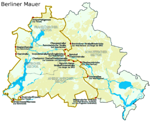
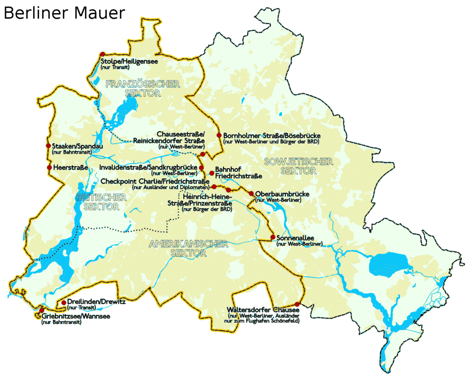
English: Placement of Berlin Wall and the border of West Berlin before 1989.
Deutsch: Darstellung zeigt Lage und Verlauf der Berliner Mauer und der Grenzübergangsstellen bis 1989.
Русский: Расположение Берлинской Стены и граница Западного Берлина до 1989 года.
|
| Date | |
| Source | based on Image:Karte_berliner_mauer_de.jpg, but in vivid colours and reduced data size |
| Author | Incnis Mrsi, based on Sansculotte's work |
| Other versions |
Image:Karte_berliner_mauer_de.jpg (JPEG original) |
Licensing[edit]
|
I, the copyright holder of this work, hereby publish it under the following licenses:
You may select the license of your choice.
|

File history
Click on a date/time to view the file as it appeared at that time.
| Date/Time | Thumbnail | Dimensions | User | Comment | |
|---|---|---|---|---|---|
| current | 19:54, 23 July 2013 | | 1,366 × 1,098 (133 KB) | Ras67 (talk | contribs) | cropped |
| 21:07, 18 December 2007 |  | 1,368 × 1,100 (134 KB) | Incnis Mrsi (talk | contribs) | {{Information |Description= Darstellung zeigt Lage und Verlauf der Berliner Mauer und der Grenzübergangsstellen bis 1989. Placement of Berlin Wall and the border of West Berlin before 1989. |Source=based on Image:Karte_berliner_mauer_de.jpg, but in |
- You cannot overwrite this file.
File usage on Commons
The following 3 pages link to this file:
File usage on other wikis
The following other wikis use this file:
- Usage on de.wikipedia.org
- Usage on de.wikibooks.org
- Usage on ja.wikipedia.org
- Usage on pl.wikipedia.org
- Usage on stq.wikipedia.org