File:Karte berliner mauer de.jpg
From Wikimedia Commons, the free media repository
No higher resolution available.
Karte_berliner_mauer_de.jpg (748 × 600 pixels, file size: 221 KB, MIME type: image/jpeg)
Summary[edit]
| Description |
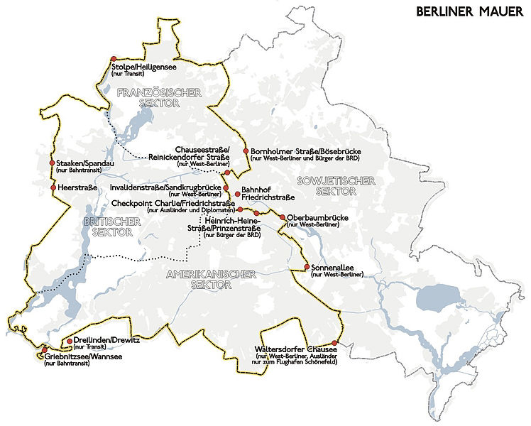
Deutsch: Darstellung zeigt Lage und Verlauf der Berliner Mauer und der Grenzübergangsstellen bis 1989.
05/2004 A. Darmochwal - Benutzung im Rahmen der GNU FDL gestattet English: Placement of Berlin Wall and the border of West Berlin before 1989.
|
| Date | |
| Source | Own work |
| Author | Sansculotte |
| Other versions |
Image:Karte_berliner_mauer_de.png (in vivid colours and reduced data size) |
Licensing[edit]
Zeichnung erstellt 2004 von User:Sansculotte. Bild ist unter der GNU FDL und CC-BY-SA-2.0 zur weiteren Verwendung freigegeben.
Quellenangabe und Beleg an sansculotte@despammed.com erbeten.
| This file is licensed under the Creative Commons Attribution-Share Alike 2.0 Germany license. |
 |
|
|
 |
Permission is granted to copy, distribute and/or modify this document under the terms of the GNU Free Documentation License, Version 1.2 or any later version published by the Free Software Foundation; with no Invariant Sections, no Front-Cover Texts, and no Back-Cover Texts. A copy of the license is included in the section entitled GNU Free Documentation License. |
| This file is licensed under the Creative Commons Attribution-Share Alike 3.0 Unported license. | ||
|
||
| This licensing tag was added to this file as part of the GFDL licensing update. |
 |
Attribution information, such as the author's name, e-mail, website, or signature, that was once visible in the image itself has been moved into the image metadata and/or image description page. This makes the image easier to reuse and more language-neutral, and makes the text easier to process and search for. Commons discourages placing visible author information in images.
|
File history
Click on a date/time to view the file as it appeared at that time.
| Date/Time | Thumbnail | Dimensions | User | Comment | |
|---|---|---|---|---|---|
| current | 06:54, 25 August 2013 | | 748 × 600 (221 KB) | Spiridon Ion Cepleanu (talk | contribs) | Color removed |
| 19:30, 23 July 2013 | 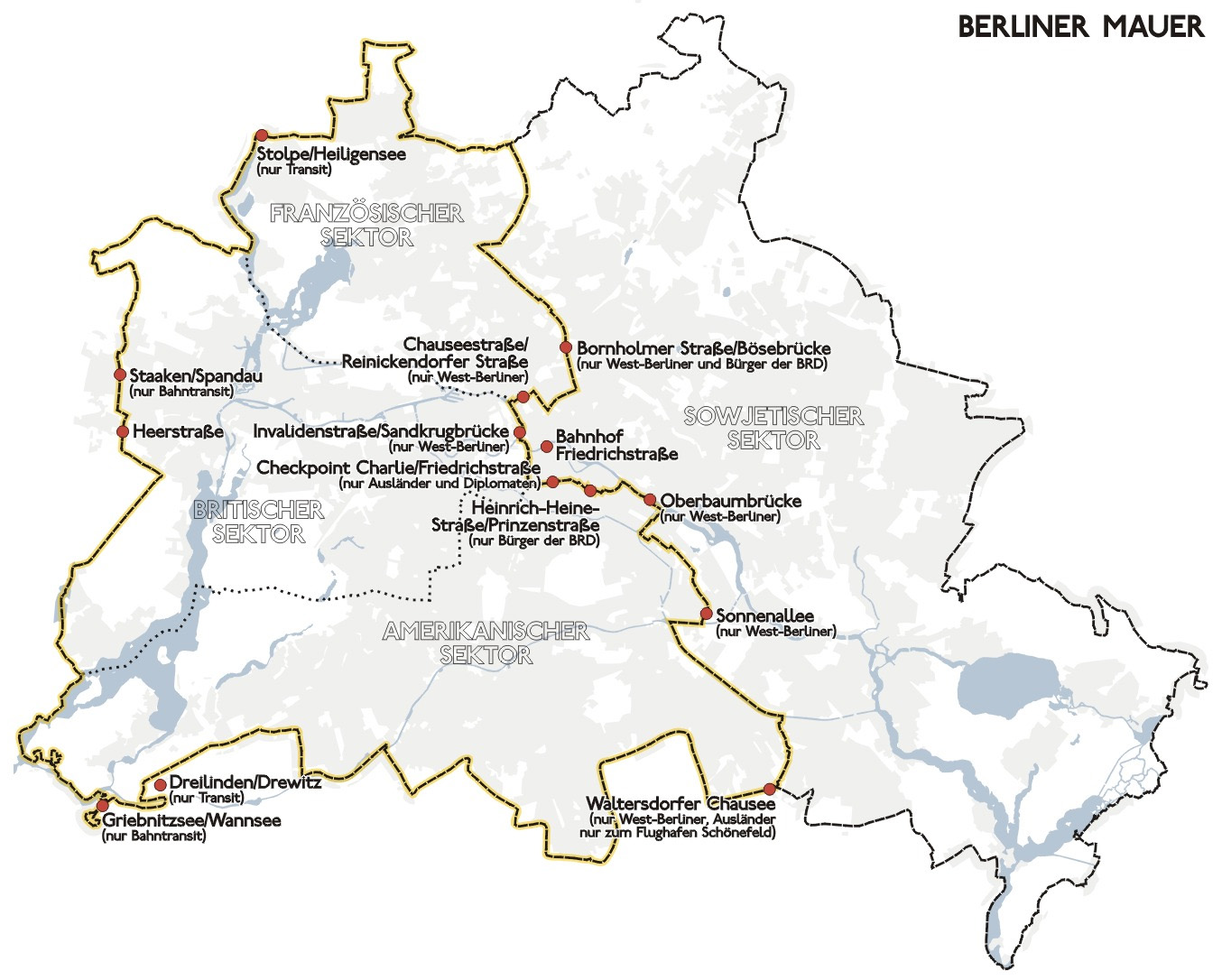 | 1,354 × 1,086 (263 KB) | Ras67 (talk | contribs) | cropped and watermark removed | |
| 17:46, 30 July 2005 |  | 1,368 × 1,100 (239 KB) | Sansculotte (talk | contribs) | Darstellung zeigt Lage und Verlauf der Berliner Mauer und der Grenzübergangsstellen bis 1989. Zeichnung erstellt 2004 von Benutzer:Sansculotte. Bild ist unter der GNU FDL zur weiteren Verwendung freigegeben. '''Quellenangabe und Beleg an [mailt |
- You cannot overwrite this file.
File usage on Commons
The following page links to this file:
File usage on other wikis
The following other wikis use this file:
- Usage on ast.wikipedia.org
- Usage on bg.wikipedia.org
- Usage on de.wikipedia.org
- Usage on eo.wikipedia.org
- Usage on es.wikipedia.org
- Usage on ext.wikipedia.org
- Usage on fr.wikipedia.org
- Usage on hu.wikipedia.org
- Usage on la.wikipedia.org
- Usage on li.wikipedia.org
- Usage on lt.wikipedia.org
- Usage on nl.wikipedia.org
- Usage on no.wikipedia.org
- Usage on pl.wikipedia.org
- Usage on ru.wikipedia.org
- Usage on sl.wikipedia.org